What the Ground Is Telling You: How to Read Soil and Geological Data Before You Commit to a Land Purchase
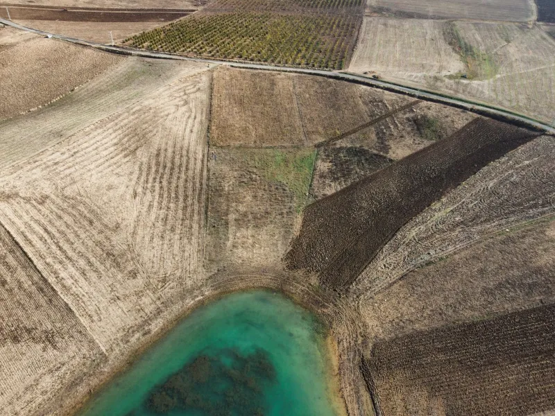
The price of a parcel of land is visible. The condition of the ground beneath it is not. Two adjacent tracts of forty acres each, selling at identical prices in the same rural county, may represent dramatically different investment propositions once the subsurface reality is understood. One may sit atop deep, well-draining loam ideal for construction and agriculture. The other may conceal expansive clay soils, a high seasonal water table, or fractured bedrock that renders conventional septic systems impossible and foundation construction prohibitively expensive.
For most buyers, this distinction only becomes apparent after closing—when the excavator hits unexpected material, the engineer delivers a troubling report, or the county health department rejects a septic permit application. For buyers who understand how to read publicly available soil data and interpret geotechnical findings before making an offer, these discoveries arrive on schedule, during due diligence, when they can still influence the price or the decision to walk away entirely.
The Publicly Available Data Most Buyers Never Consult
The United States Department of Agriculture's Natural Resources Conservation Service maintains one of the most comprehensive soil mapping databases in the world, available free of charge through a web-based tool called the Web Soil Survey. This resource covers virtually every county in the contiguous United States and provides detailed information on soil series, drainage class, organic matter content, permeability, and—critically for land buyers—suitability ratings for a wide range of uses including dwellings with basements, septic absorption fields, agricultural crops, and road construction.
Despite its availability, the Web Soil Survey is consulted by a small minority of land purchasers. Most buyers rely on visual inspection, seller representations, and general familiarity with the region. This gap between available information and actual buyer behavior creates a persistent inefficiency in rural land markets—one that benefits those who do their homework.
A parcel flagged in the Web Soil Survey as having "severe limitations" for septic systems due to a restrictive layer at shallow depth may be listed and priced as though it were a standard buildable lot. A buyer armed with that data can either negotiate a meaningful price reduction, budget accurately for an engineered alternative system, or decide the parcel does not meet their criteria and move on before incurring any further cost.
Understanding Soil Series and What They Mean in Practice
Soil scientists classify soils into series—named groupings with consistent physical and chemical characteristics. In the United States, more than 20,000 soil series have been formally identified and described. Understanding a few key characteristics within any series can provide substantial practical guidance for a land buyer.
Drainage class describes how quickly water moves through and away from the soil. Well-drained soils—those with a drainage class of "well" or "somewhat excessively well drained"—are generally favorable for construction and many row crops. Poorly drained or very poorly drained soils, by contrast, indicate a high seasonal water table that can compromise foundations, make conventional septic installation impossible, and limit agricultural productivity to crops tolerant of wet conditions.
Soil texture describes the relative proportions of sand, silt, and clay particles. Heavy clay soils are notorious for shrink-swell behavior—expanding when wet and contracting when dry—which can impose significant stress on foundations and underground utilities. Sandy soils drain readily but may lack the bearing capacity required for heavy structures without engineered footings.
Permeability measures how quickly water moves through the soil profile. For buyers planning to install a conventional septic system, permeability is among the most consequential data points available. Soils with very low permeability may require a mound system, drip-irrigation system, or other engineered alternative—each of which adds cost and may require additional permitting.
Depth to restrictive layer describes how far below the surface a layer of material exists that significantly impedes root growth, water movement, or excavation. Shallow bedrock, hardpan, or fragipan layers can dramatically increase the cost of any subsurface work, from utility trenching to foundation excavation.
When Publicly Available Data Is Not Enough
The Web Soil Survey and county soil maps provide valuable generalized information, but they are derived from surveys conducted at a regional scale. A single soil map unit may encompass several acres, meaning that conditions within a specific building envelope or development zone on a parcel may differ from the mapped average.
For transactions involving significant capital commitment—commercial development, subdivision, agricultural conversion, or industrial use—a site-specific geotechnical investigation is not a luxury; it is a fundamental component of responsible due diligence.
A geotechnical report, produced by a licensed geotechnical engineer following soil borings or test pits at the site, provides data that no publicly available map can replicate: actual bearing capacity at the proposed foundation depth, actual groundwater levels at the time of investigation, actual material classification at the precise locations where construction is planned, and professional recommendations for foundation type, earthwork, and drainage design.
The cost of a geotechnical investigation varies with site size and complexity, but a basic report for a residential or small commercial site typically ranges from $2,500 to $8,000. On a parcel priced at $200,000 or more, this represents a modest insurance premium against the far greater cost of discovering unfavorable conditions after construction has commenced.
Reading Geology at the Regional Scale
Beyond soil characteristics, the broader geological context of a parcel can reveal both opportunities and risks that are not visible in a soil survey.
In karst regions—areas underlain by soluble limestone or dolomite, common across large portions of Florida, Kentucky, Tennessee, Missouri, and the mid-Atlantic states—the subsurface may contain voids, caves, or sinkholes that pose genuine structural risk to any development. Properties in mapped karst areas warrant additional investigation, including geophysical surveys and review of the USGS karst hazard literature for the region.
In areas with documented seismic activity, soil liquefaction potential—the tendency of saturated, loosely packed soils to behave like a liquid during an earthquake—is a material consideration for any structure. The USGS publishes seismic hazard maps that can be cross-referenced against a parcel's soil classification to assess this risk.
Conversely, regional geology can create value as well as risk. Parcels underlain by commercially significant aggregate deposits—sand, gravel, limestone—may carry extractive value that is not reflected in the listed price. Agricultural land positioned over productive aquifer systems holds irrigation potential that may not be immediately apparent to a buyer focused solely on surface characteristics.
Translating Soil Data into Investment Decisions
For buyers who take the time to integrate soil and geological data into their acquisition analysis, the practical applications are numerous.
A parcel listed as agricultural land but underlain by deep, well-structured soils with excellent drainage and minimal limitations may be significantly undervalued if the local market has not recognized its development potential. A buyer who identifies this discrepancy—and confirms it with a geotechnical report—can acquire ground with genuine upside that competitors overlooked.
Equally, a parcel priced as a buildable residential lot but carrying a soil profile with severe septic limitations and a shallow seasonal water table may be overpriced by tens of thousands of dollars once the cost of engineered systems and permitting delays is properly accounted for. Knowing this before making an offer is the difference between a profitable acquisition and a protracted, expensive disappointment.
The ground does not conceal its nature indefinitely. Soils behave according to their physical properties regardless of what a seller represents or a listing price implies. The buyers who learn to read that data—and to seek professional interpretation when the stakes are high—are the ones who build durable, well-priced land portfolios over time. The information is available. The advantage belongs to those who use it.